Property Record
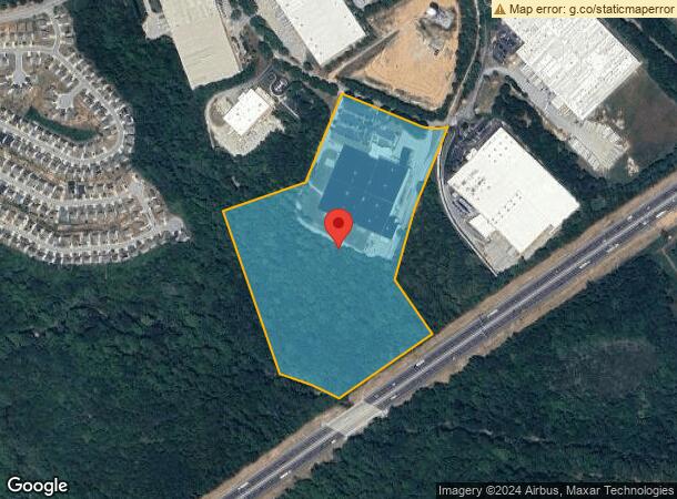
234 S Holland Dr, Pendergrass, GA 30567

NEARBY LISTINGS FOR SALE OR LEASE
Property Detail
234 S Holland Dr
092-028
Survey For Stone Mountain Indsutrial Par
Publicstorage
30.7273 ACRES PLAT BOOK 50 PAGE 50
X
Jackson
13139C0350G
Georgia
2023
30.72 AC
2023
Braselton/W Jackson
010104
Atlanta
183,919 SF
Jefferson, GA
DEMOGRAPHICS near 234 S Holland Dr
1 Mile
3 Mile
5 Mile
2024 Total Population
1,150
8,176
29,888
2029 Population
1,458
10,470
38,191
Pop Growth 2024-2029
+ 26.78%
+ 28.06%
+ 27.78%
Average Age
37
37
37
2024 Total Households
372
2,620
9,713
HH Growth 2024-2029
+ 25.27%
+ 26.56%
+ 26.32%
Median Household Inc
$67,848
$72,551
$84,674
Avg Household Size
3.00
3.00
3.00
2024 Avg HH Vehicles
2.00
3.00
3.00
Median Home Value
$336,160
$315,244
$329,832
Median Year Built
2005
2004
2004
Nearby Places
- Restaurants
- Banks
- Shops
- Fitness
- Groceries
SALE & LEASE HISTORY
LISTING DATE
SALE/LEASE

Sep 12, 2018
For Sale
Nearby Properties
Address
Land Use
TOTAL SIZE
Lot Size
Zoning
Address
Land Use
TOTAL SIZE
Lot Size
Zoning
1,131,000 SF
94.67 AC
LI
Address
Land Use
TOTAL SIZE
Lot Size
Zoning
500,000 SF
137.67 AC
E1
Address
Land Use
TOTAL SIZE
Lot Size
Zoning
999,205 SF
74.81 AC
L-I
Address
Land Use
TOTAL SIZE
Lot Size
Zoning
1,053,360 SF
101.96 AC
001
Address
Land Use
TOTAL SIZE
Lot Size
Zoning
815,112 SF
104.67 AC
LI
Address
Land Use
TOTAL SIZE
Lot Size
Zoning
517,500 SF
79.14 AC
R1
Address
Land Use
TOTAL SIZE
Lot Size
Zoning
639,000 SF
70.16 AC
LI
Address
Land Use
TOTAL SIZE
Lot Size
Zoning
749,700 SF
44.96 AC
LI
Address
Land Use
TOTAL SIZE
Lot Size
Zoning
820,800 SF
46.50 AC
LI
Address
Land Use
TOTAL SIZE
Lot Size
Zoning
1,120,106 SF
66.43 AC
Address
Land Use
TOTAL SIZE
Lot Size
Zoning
719,200 SF
113.14 AC
M1
Address
Land Use
TOTAL SIZE
Lot Size
Zoning
147.44 AC
MI
Address
Land Use
TOTAL SIZE
Lot Size
Zoning
10,803 SF
74.86 AC
C2
Address
Land Use
TOTAL SIZE
Lot Size
Zoning
458,655 SF
37.64 AC
003
Address
Land Use
TOTAL SIZE
Lot Size
Zoning
238,200 SF
17.29 AC
M1
Address
Land Use
TOTAL SIZE
Lot Size
Zoning
518,125 SF
28.51 AC
I2
Address
Land Use
TOTAL SIZE
Lot Size
Zoning
151.22 AC
MI
Address
Land Use
TOTAL SIZE
Lot Size
Zoning
366,300 SF
123.06 AC
I2
Address
Land Use
TOTAL SIZE
Lot Size
Zoning
395,960 SF
52.18 AC
I
Address
Land Use
TOTAL SIZE
Lot Size
Zoning
195,200 SF
14.37 AC
003
Address
Land Use
TOTAL SIZE
Lot Size
Zoning
369,844 SF
30.07 AC
001
Address
Land Use
TOTAL SIZE
Lot Size
Zoning
291,941 SF
19.20 AC
MI
Address
Land Use
TOTAL SIZE
Lot Size
Zoning
83,184 SF
9.90 AC
LI
Address
Land Use
TOTAL SIZE
Lot Size
Zoning
249,518 SF
23.27 AC
003
Address
Land Use
TOTAL SIZE
Lot Size
Zoning
571.37 AC
003
Address
Land Use
TOTAL SIZE
Lot Size
Zoning
154,672 SF
15.50 AC
MI
Address
Land Use
TOTAL SIZE
Lot Size
Zoning
21.80 AC
001
Address
Land Use
TOTAL SIZE
Lot Size
Zoning
21.80 AC
001
Address
Land Use
TOTAL SIZE
Lot Size
Zoning
198,150 SF
9.14 AC
003
The World's #1 Commercial Real Estate Marketplace
Connect with us
© 2025 CoStar Group
The information above has been obtained from sources believed reliable. While we do not doubt its accuracy we have not verified it and make no guarantee, warranty or representation about it. It is your responsibility to independently confirm its accuracy and completeness. Any projections, opinions, assumptions, or estimates used are for example only and do not represent the current or future performance of the property. The value of this transaction to you depends on tax and other factors which should be evaluated by your tax, financial, and legal advisors. You and your advisors should conduct a careful, independent investigation of the property to determine to your satisfaction the suitability of the property for your needs.